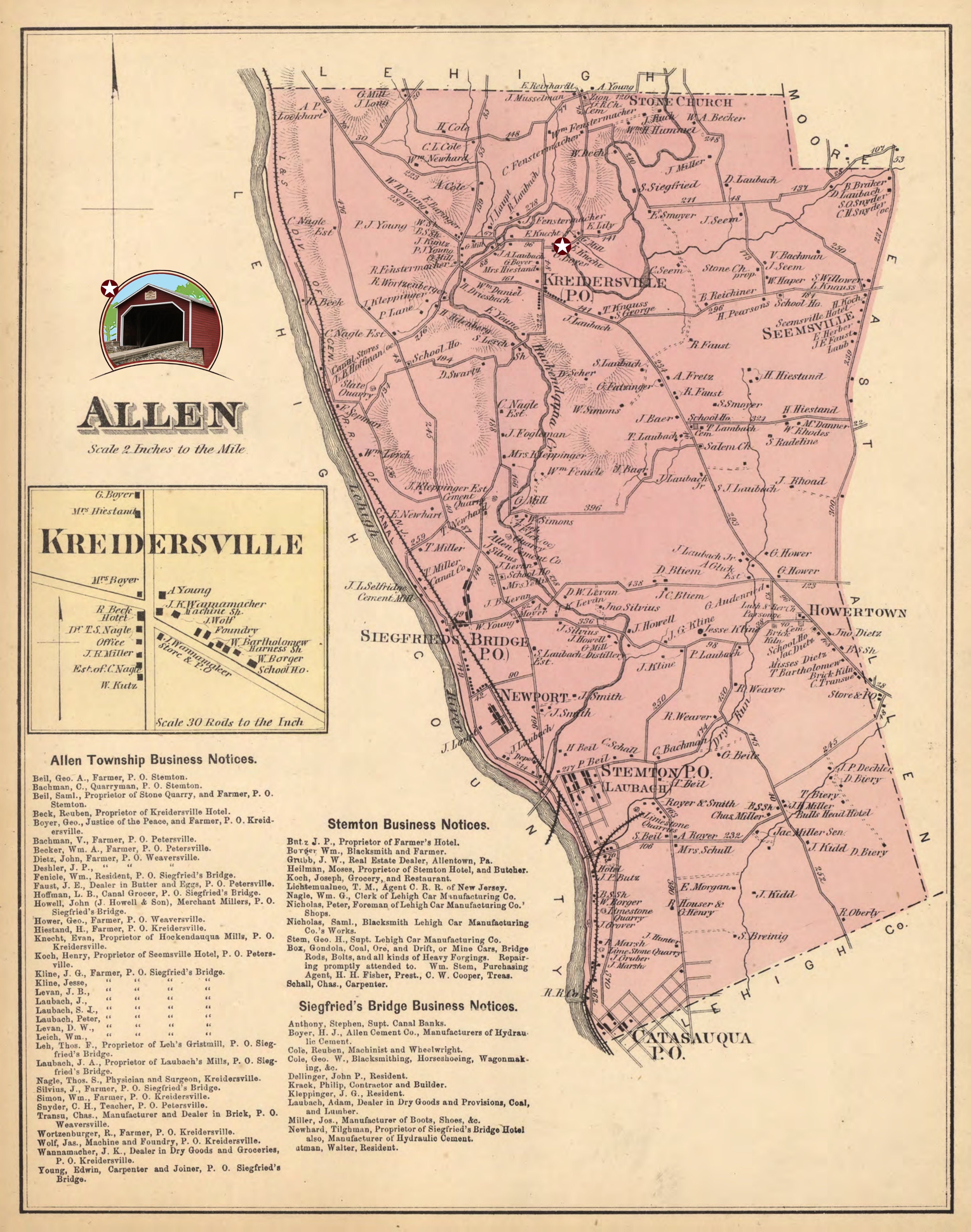
Allen Township Map (1874)
Take a step back in time and see what Allen Township was like in 1874! When this map was created, the Covered Bridge was just 35 years old. The map is marked with a star to show the location of the Covered Bridge.
Please allow several moments for the map to load into the viewer below. You can use the zoom controls, arrows or mouse wheel to navigate. On mobile devices you can use your fingers to zoom in or move around.